Tibet Information
General considerations |
| Tibet is not an easy region for bike touring. This refers not only to the necessary riding skills and physical condition, but rather to the logistics involved with such a trip. Unless you are cycling on major routes (like Lhasa-Khatmandu), you will have to be completely self supported and self supplied. This includes that you must be able to carry out all necessary repairs on your bike and equipment, that you can carry food supplies for several days, and that you can cope with the harsh climate and high altitude. | ||
 |
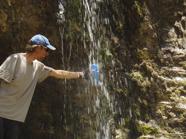
Despite the difficulties and challenges, Tibet is a wonderful country with fascinating landscapes, mostly friendly people, and great remote tracks for cycling. It is addictive! | 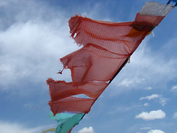 |
Maps and guide books |
| we
found the following maps and books useful for planning and navigation
on tour: |
||
| Geographical
Map of Tibet Gizi Map, Hungary 1: 2 000 000 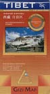 Nice map for rough orientation. Roads with distance marks; however, some distances incorrect.Towns are marked in English, Chinese and Tibetan. good for planning and rough navigation; it has several errors |
Road
Map Himalaya/Tibet Gecko Maps, Switzerland 1: 1 600 000 
Very accuarate road information with distances, including geographic information. Covers whole Himalaya region. In English great resource, but it is of huge size |
Chinese
Province Map of Tibet Autonomous Region Star publishing house; China 1: 2 000 000  Political map with province and county borders. No topography, no distance marks. Accurate details about roads. No distance marks. In Chinese ideal for on the trip due to Chinese place names; is available in bookstores in large cities in China |
| Russian
Topographic Maps 1: 200 000 They are excellent topographic maps with lots of details. In Russian. Available at the State Library in Berlin). We take photocopies and scans along during the trip. If you can - take these, especially for offroad and back-country trips! some russian maps of central Asia (1:500 000) can be downloaded at mapstor  Studying the Russian topographic maps of the Chang Tang plateau |
China
Road Atlas available in bookstores in China 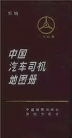 Very accuarate road information with distances. No topographic information, but rivers, railroads and some mountain peaks are marked. Covers whole China. In Chinese great resource for planning of back-country trips. |
|
| Mapping
the Tibetan World Osada Y, Allwright G, Kanamaru A (2000) Kotan Publishing ISBN: 0-9701716-0-9 Great resource for planning and on tour! Detailed sketches, city maps, and lots of useful information about traveling Tibet and adjacent provinces (bus schedules, etc.) |
Tibet
Overland McConnell K (2002) Trailblazer Publications ISBN: 1-873756-41-0 Detailed road book for the main bicycle routes in Tibet: Lhasa - Kathmandu, Lhasa - Kailash - Kashgar, and East Tibetan routes. Great for planning and estimation of distances and riding time. |
Open-source
and free-ware software to view high-resolution Satellite images: Google Earth We found these tools exteremely useful to plan offroad and backcountry tours. It allows you to judge the ground properties and find possible routes. |
Food and water availability |
| Food:
In general, basic food (noodles, milk powder, biscuits) is available
in most villages and towns, but if you want to use special dehydrated
stuff, you will have to bring that from home. In Lhasa, you can
additionally find cereals, dehydrated fruit and meat, and a selection
of nuts. Along the most common roads (Friendship Highway, Xinjiang-Tibet Highway, Qinghai-Tibet-Highway) there are many smaller settlements and truck stops where food is available in shops and restaurants. Sometimes there is no shopping opportunity for one to three cycling days, but usually not more. However, on the 'Northern Route' (Ali-Gertse-Dongco-Coqen-Raka) there are longer streches of up to seven days without shopping opportunities. In East Tibet there are lots of opportunities for food supplies along the road (small shops, restaurants). The supply situation will be very different if you chose a route away from the major 'highways'. Then, you may not be able to get food for a week or more and you need to be self supplied. |
|
| Water: Finding
water can be difficult at times, since large parts of Tibet are desert-like
and many lakes are saline. Especially on the Changtang plateau we sometimes
had difficulties finding water. Make sure to carry a water sack or enough
bottles and stock up once you find a reliable source. We did not use
a filter, and drank water as it was. If in doubt, we used water purification
tablets. Water is available in all settlements and nomad tents - if you ask for water, you will often be given hot water. |
 |
| Fuel
for the stove: Make sure to bring a stove that can use any kind
of petrol, including diesel. Fuel is of low quality, you may have to
clean your stove more often. In West Tibet you can get 93-octane fuel or diesel at truck stops and bigger villages directly from fuel barrels (where there's traffic, there's fuel). In East Tibet there is a network of modern gas stations in the bigger towns (Meldro Gungkar, Ngapo Zampa, Bayi, Nyingchi, Bomi, Baxoi, Bamda, Zuogong, etc.). We were unsuccessful in finding white gas in Tibet. |
|
Roads, tracks, and traffic |
| West
Tibet, Central Tibet: Major roads are very bad - be warned!
These roads are truck highways and they are pooly maintained, you will
be riding on perfect washboard roads most of the time. In addition,
due to truck traffic it is also very dusty. Minor roads often are by
far better to ride on, as they are not being destroyed by heavy truck
traffic. Be prepared for cobble stones, sand, river beds, steep slopes,
etc. Road construction season seems to be from May 1st until end of
October - road construction camps are closed outside this season. Friendship Highway: the main road of the Friendship Higway (road 318) in the Yarlung Tsangpo valley is being rebuilt and paved between Lhasa and Lhatse. There is a lot of traffic, trucks, buses, and jeeps. East Tibet: A lot of stretches on road 318 are now paved, and there is more to come in the next few years, as there is quite some road construction activity. The dirt roads are still challenging due to mud after rain events. On some stretches there was a lot of traffic. |
|
| Details to some
of the major roads: |
|
|
Xinjiang - Tibet Highway
(Kargilik to Domar; road 219) |
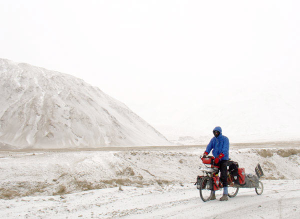 snowy morning, Xaidulla |
| Westtibet
(Domar - Gertse) |
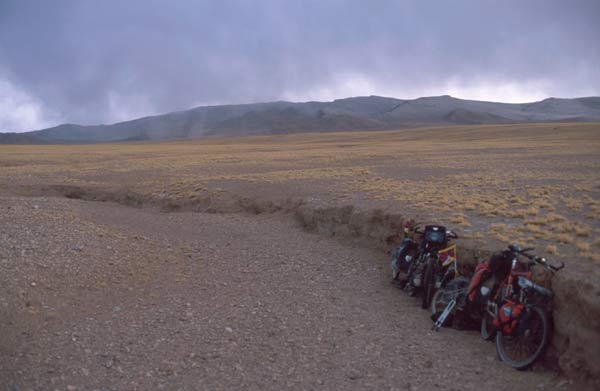 evening in the Changtang |
| Transhimalaya
Road (Dongco - Coqen - Raka) |
 TakydCo (5170m) |
| Friendship
Highway (Lhatse to Lhasa; road 318) |
 Yarlung Tsangpo valley |
| East
Tibet (Lhasa to Zuogong; road 318/214) |
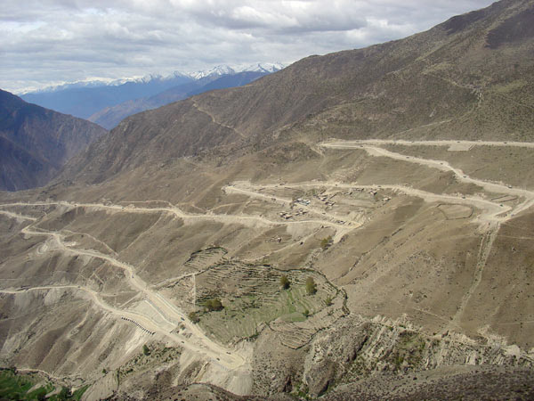 switchbacks to Gama La (4618m) |
| Hitchhiking on trucks:
|
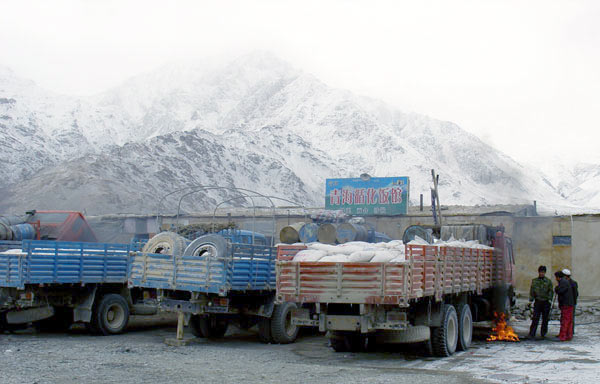 trucks in Xaidulla |
Useful gear and equipment |
| Anything you bring on a trip to Tibet should be robust to withstand rough conditions and it is recommended to travel as light-weight as possible - there are many steep and high mountain passes. Here, we specifically not present a complete packing list (some of the standard equipment we use), as we believe that this is too variable between individuals and often it does not really matter. Rather, we would like to point out a number of 'small things' and a few tips that can be useful specifically for Tibet: | |
| Tent: needs to be stable in storms, make sure you know how to build it up during high winds. Vestibules should be large enough to allow cooking inside during stormy weather. A free-standing tent can be advantageous, since sometimes the ground is very hard. We used a two-person tunnel tent and were very much satisfied with it. | 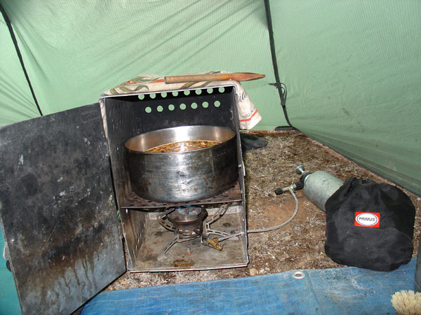 |
| Clothing: be prepared for strong cold wind. We preferred to just wear a thin windbreaker jacket over our thermal underwear, a fleece jacket was useful for cold evenings. Our favorite 'new' piece of equipment were the self-designed and custom-made felt booties which were great to keep our feet warm in snow and on cold days. | 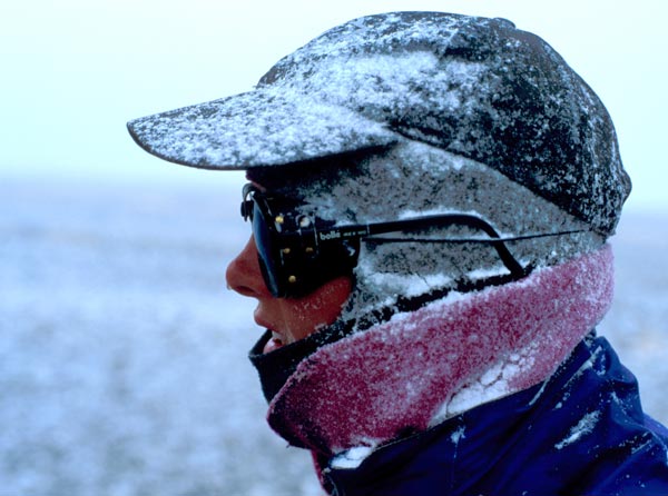 |
| Bike parts: a suspension fork is highly recommended (with suitable front rack, e.g. from Faiv), the Speedhub gearing system makes riding more comfortable and less service-intensive. The use of a bike trailer is up to personal taste - we prefer the low center of gravity to a fully loaded rear rack. | 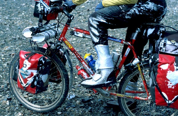 |
| Candies: to keep the throat moist during cycling in high altitude in a very dry environment, we carried some candies. Taking candies every now and then helped against developing sore throat and cough during our stay over 5000m. Our favorites included sugar-free Fishermans Friend, and some herbal non-sugar candies brought from home. Various Chinese candies are available in huge selections at truck stops and in any village. | |
| Hand creme: in the dry high altitude environment of the Aksai Chin and the Chang Tang a good hand creme can prevent fingers and lips from cracking open. | |
Weather and travel season |
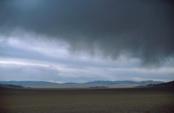
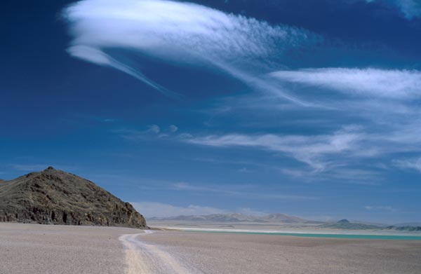
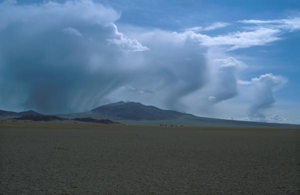
| Be prepared for everything. In high altitudes, weather changes can happen fast, and usually there are large temperature changes associated with it. Basically if the sun is out, it is hot and if the sun is gone, it is cold. We had snow storms, rain, strong wind, as well as clear blue sky (all that even in one day). Be aware that the sun is very intense at high altitudes. Wind usually started around noon time, and became strongest in the late afternoon; during the night there was usually no wind. | |
| Which
is the best time to travel? Travels to Tibet are possible all year
round, here are some considerations: March-May: We chose this time of year, although it is not the main travel season. In some regions of north-west Tibet we were literally stuck in the snow end of March, but otherwise the spring season was very nice - lots of wildlife activities, and early blooming flowers. In contrast to what most people may imagine, spring time is a very dry season, we often had difficulties finding (liquid) water. Furthermore, spring time is very windy - in West Tibet we had a strong west wind in April. June-August: this is the rainy season with strong thunderstorms. It may be difficult to cycle some of the tracks due to mud. September-Novemer: ideal travel season, dry weather, clear sky. December-February: winter will be cold, but winter landscape is beautiful! |
 |
 |
|
 |
|
People along the way |
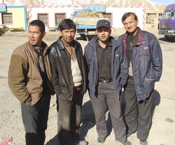
| General: During our tour from West to East across Tibet, we met people of different ethnic backgrounds and culture. While in west Tibet we mainly met nomads, the Tibetans in the Yarlung Tsangpo valley and the East Tibetan Khampas are farmers. As truck drivers we met Tibetans as well as Uighurs from Xinjiang. At road construction camps, we saw different ethnic groups. Actually, we did not feel so comfortable with the road workers, they were rather pushy. However, there was never any incident that made us feel unsafe. | |
| West
Tibet: Our experinece with people along the Xinjiang-Tibet Highway
was always very positive. The Uighurs and Hui people are curious and
very friendly. The truck drivers (mainly Uighurs) were helpful and considerate.
We felt comfortable eating and sleeping at muslim restaurants along
the way. Nomads of West Tibet and the ChangTang were curious, friendly, but also quite shy. Often, children and women were afraid of our appearance, they would disappear into their houses or tents when we approached. Asking nomads for distances and directions often was difficult, they did not seem to understand our pronuciations of place names and they certainly don't know about kilometers. Friendship Highway: In contrast to the friendly folks of West Tibet, our experinece with the people along the main road 318 of the Friendship Highway was not so great. Nothing serious happended, but crowds of road workers shouting their 'hello' after us, kids running after us, and begging children and women did not really make us feel very comfortable. East Tibet: Along road 318, people in villages sometimes shouted 'hello', 'ok' after us, and kids tried to run after us. It became very clear that those people were used to the sight of (cycling) tourist passing by. This changed drastically when we were on the small road along the WiChu river - suddenly adult people were friendly but more shy, no yelling anymore, no begging, and children were silently watching with big eyes or even running away from us. In East Tibet, we also saw many pilgrims, and actually they seemed to understand what bike touring is about. Villages and towns: We found people in larger villages to behave quite different from those in the county side. Especially in those new Chinese settlements, men would just sit in the street, do nothing and stare at us. The inhabitants of such villages also were not at all helpful with directions, and sometimes even shopping was a pain. An exception is Lhasa, there people are used to the sight of Western people. |
 Uighur truck drivers |
 nomads of West Tibet |
|
 farmers of East Tibet |
|
 children along the Friendship highway |
|
Dogs |
| There
are many stories about wild and aggressive dogs of Tibetan nomads. Well,
our experience was not like that. Picking up one or two stones before
entering the village or passing settlements proved to be a good strategy
to have something ready to throw, in case a dog came too close. While dogs of the tent nomads were quite well behaving, those at road construction camps and in settlements were more aggressive. Although, luckily we had no serious problems with dogs, we did hear of others who were chased and also bitten (especially in the town Markam, East Tibet). Be alert, but don't be paranoid. |
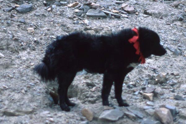 dog of a nomad family |
Visa and permits |
| To
enter Tibet, a visa for China is necessary, Tibet should not be stated
in the Chinese visa application. The standard tourist visa is valid
for 30 days, but it can be prolonged within China (not necessarily in
Tibet!) without problems. If you want to apply for a longer visa (e.g.
90 days), a letter of recommendation or inviation is useful, which can
be obtained also through some visa agencies. HongKong is a good place
to get long-term visas without problems from various travel agencies. Visa elongation within Tibet is very difficult. People have reported to get visa extensions in Lhasa, Shigatse, and Ali. However, most of the time you will not be given another 30 days, and the extension you get may depend on your negotiaton skills or the officer's mood. For more information, bowse through the tips and tricks for Independent Travel to Tibet, collected by the Australian Tibet Council. |
|
| Be aware that if
you are traveling within Tibet without an 'Alien Travel Permit', you
are traveling in a legal gray zone. In the worst case you will be fined
and sent back on the next bus or truck. However, it seems like the situation is becoming more relaxed, and the routes along the Friendship Highway, East Tibet Highway (road 318), as well as Lhasa-Kailash-Ali may become officially 'open' for individual tourists in future. |
 |
